How can we prepare for the impacts of a changing climate?
Irina Marinov, associate professor at the Department of Earth and Environmental Science, leads a research community focused on understanding global climate impacts, risks, and vulnerabilities to enable local action.

By Xime Trujillo
“The Global Climate Security Atlas is a place to start searching for answers,” says Irina Marinov, associate professor at the Department of Earth and Environmental Science and leader of the Environmental Innovations Initiative (EII) research community Global Climate Impacts, Risks, and Vulnerabilities.
Addressing climate impacts requires informed actions at local, national, and global levels. As a result, there is a growing demand for data visualization tools that can help navigate information related to climate science, its impacts, and potential solutions. In response to this need, in 2021 Marinov, research associate and oceanographer Anna Cabre, and Michael Weisberg, professor at the Department of Philosophy, with support from Penn Global, Perry World House and Penn students, started to develop the Global Climate Security Atlas (the Atlas), an interactive digital tool showcasing climate impacts and vulnerability factors on a global scale.
To build on the Atlas’ functionalities, starting in 2024, Marinov used EII research community support to gather experts from around campus to collaborate on long-term climate action and identify regions highly susceptible to climate-related risks.
Mapping climate related risk
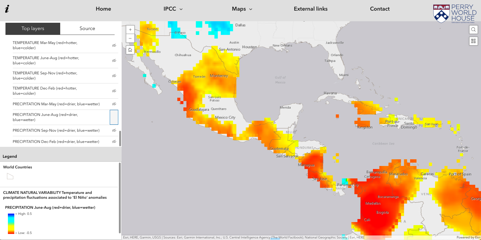
Climate change affects the environment in various ways, including through sea level rise, drought, wildfires, flooding, ocean acidification, and more. These environmental changes affect critical systems, such as water, energy, transportation, food, ecosystems, and human health. Knowing that clear, accessible presentation of data about this broad range of impacts can enable action, Marinov and colleagues dug into the results from the Sixth Assessment Report (AR6) of the United Nations Intergovernmental Panel on Climate Change (IPCC)—the world’s most authoritative source of scientific information related to climate change. Each of the IPCC reports is written by hundreds of experts around the world, who volunteer in working groups to summarize key scientific findings that can aid policymakers in making informed decisions. Marinov and her colleagues compiled the impacts identified by IPCC Working Group 1 (WG 1), which focuses on the physical science that underpins climate change, with the risk assessment of the IPCC Working Group 2 (WG 2), which focuses on the impacts of climate change on ecosystems and society, to collaboratively create a multidisciplinary digital data visualization platform showcasing global climate hazards, impacts, adaptation, and vulnerability.
Geared toward enhancing climate action, the Atlas catalogs critical risk elements. “Risk is defined as the climate hazard times the socioeconomic issue,” explains Marinov. With funding from EII, Marinov built upon the Atlas in collaboration with colleagues as well as undergraduate students. Serving as a base for discussion for the research community, the Atlas is organized in nine topics, similar to how the IPCC results are presented. The topics include temperature and precipitation projections, as well as projected impacts, such as extreme heat events, floods, droughts, and ice melting. The Atlas also provides an overview of risk assessments for climate-related harms, such as food and water insecurity, biodiversity loss, and social and political vulnerabilities, along with the scientific sources behind these calculations.
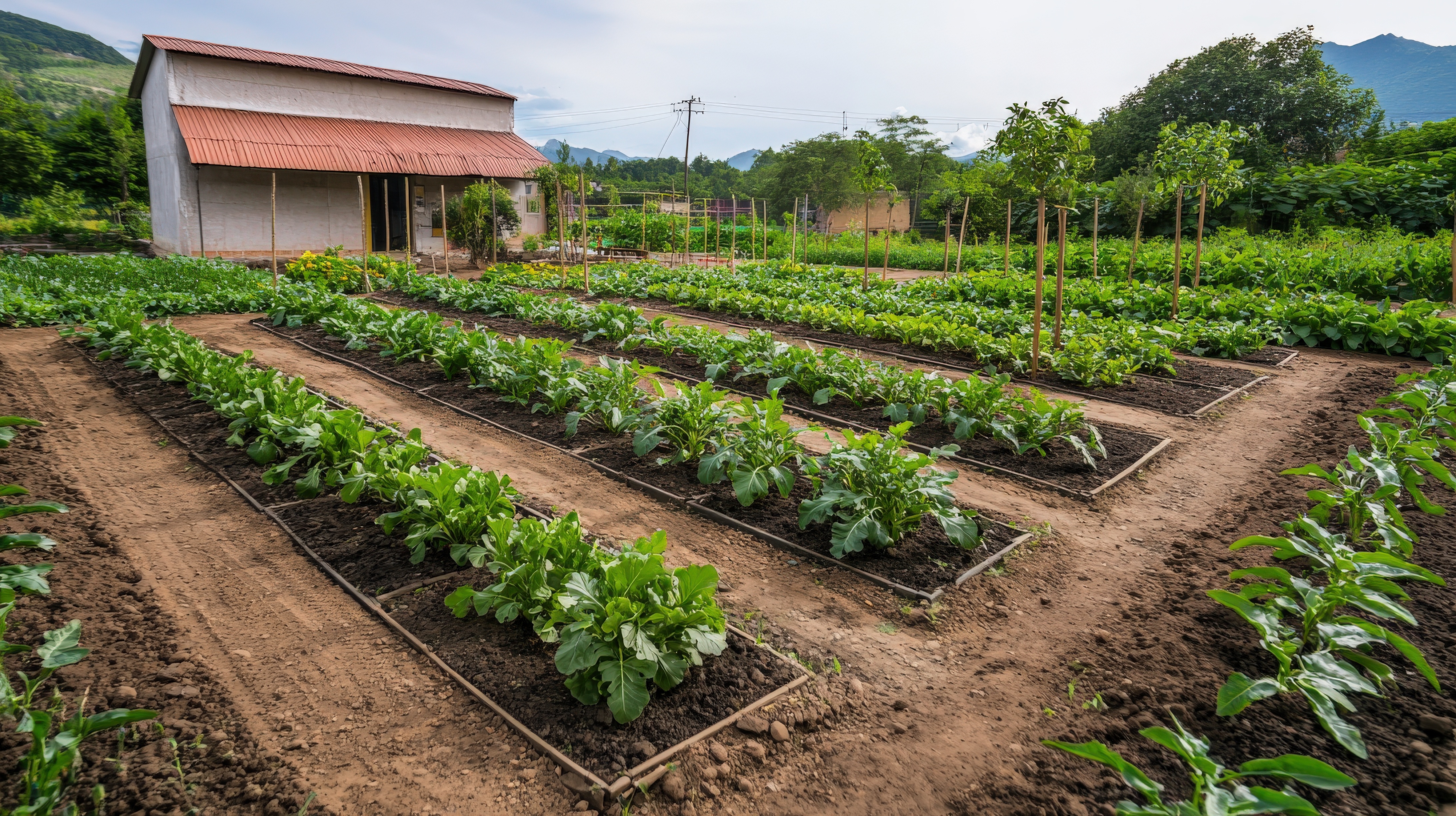
Many, many variables go into projecting the potential consequences of a changing climate. As a result, the scientific literature on climate risk is extensive. “Several papers calculate risks for different sectors like water, food, energy, etc. Therefore, there is more than one answer to the climate risk question,” explains Marinov. For instance, smallholder farmers may face a risk of water scarcity due to various compounding factors, such as drought, crop type, and access to efficient irrigation. This combination of risk factors is just one of many possible scenarios that could contribute to water insecurity for small farmers. Other variables, such as water resources management strategies or water use rights, may also play significant roles.
“Several papers calculate risks for different sectors like water, food, energy, etc. Therefore, there is more than one answer to the climate risk question”- Irina Marinov, associate professor, Department of Earth & Environmental Science, School of Arts & Sciences
Identifying highly susceptible regions
Mapping climate risks is the first step in working toward a healthy climate and enhancing global security. Understanding the connections between different types of climate risk is also crucial to enable action. For example, water scarcity affecting small farmers in a given region can lead to food insecurity. To map these linkages, Marinov and Cabre, have structured it to combine data sources and visualize potential climate threats to global security. Users of the Atlas can view global data on irrigation, drought, rainfall, and temperature, as well as predefined climate and social vulnerability indices from the academic literature. This comprehensive approach will ultimately help users identify regions or countries with similar vulnerability or hotspots—where intervention efforts should be prioritized. Their goal for future work is to look for additional funding to be able to expand the Atlas to more environmental variables (e.g. crop and vegetation types) at higher spatial resolution as well as combine environmental variables with socio-economic variables (e.g. trade flows, farming type, GDP/capita) in user-defined vulnerability indices.
After visualizing different types of climate risk, Marinov and Cabre found that global patterns of vulnerability are highly heterogenous. “What makes one region susceptible to adverse climate change impacts might not be the critical trigger elsewhere,” notes Cabre. So, focusing on regional climate risks that cross national boundaries is a starting point for identifying potential hotspots that could destabilize global security. Consequently, Cabre and nine students from Marinov’s Climate and Big Data class analyzed climate risk case studies across the Middle East and the Mediterranean region, as well as the area known as the Dry Corridor, which includes Honduras, El Salvador, Guatemala, and Nicaragua. Understanding climate risk in these transboundary regions helps to refine the methodology for identifying other potential hotspots. As Cabre emphasizes, “the very process of preparing and structuring the class and exercises, identifying key datasets, and framing the questions has itself become a piece of research, shaping how we define and detect climate-related risk.”
“The very process of preparing and structuring the class and exercises, identifying key datasets, and framing the questions has itself become a piece of research, shaping how we define and detect climate-related risk.”- Anna Cabre, physicist and oceanographer
Using data to inform climate action
Beyond bridging the gap between climate science and action through the Atlas, the Global Climate Security experts have engaged in dynamic education and information sessions.
In Marinov’s class, students are running Python-based analyses on a cluster of the National Science Foundation National Center for Atmospheric Research (NSF-NCAR) supercomputer. “We are running the class on NCAR because the latest results from the Coupled Model Intercomparison Project (CMIP6) are already uploaded there and they are too resource heavy to copy locally, order Peta bytes,” emphasizes Marinov. CMIP6 is the sixth phase of CMIP, a project of the World Climate Research Programme (WCRP), providing climate projections to understand past, present, and future climate changes by bringing together expertise from a variety of disciplines and from around the globe. The “coupled” part of the name refers to models that are coupled atmosphere-ocean General Circulation Models (GCMs), or digital versions of Earth, coded to predict the flows of air and water in the atmosphere and the oceans, as well as the transfer of heat. “Intercomparison” refers to the need to unify climate modelling experiments run at different research centers under one framework. Given that CMIP uses models to understand how future changes in humans’ activities will impact the Earth’s future climate, its results have become essential to the IPCC and other international and national climate assessments.
As part of Marinov’s course, students map climate variables like global temperature anomalies or extreme heat events by analyzing CMIP6 forecasts and satellite images from NASA. Using Python notebooks, they analyze complex datasets for both disciplinary and interdisciplinary projects. For instance, Emile Honaminto Djohi and Iman Dahr, predoctoral fellows at PDRI-DevLab, are applying data analysis techniques to determine climate impacts on agriculture and migration from Central America; this project has earned additional support from the Goldsmith Sustainable Agriculture Fund at the Kleinman Center for Energy Policy.
To enable local action, Marinov presented about climate impacts on Philadelphia and the intersections with science at an Office of Government and Community Affairs (OGCA) First Thursday Community Meeting, led by Glenn D. Bryan, OGCA’s assistant vice president. These information sessions provide a valuable platform to discuss climate impacts and propose local solutions in West Philadelphia. In a world where access to accurate information is crucial for driving change, empowering communities is essential for enabling collective action to mitigate climate risk.
The group is continuing this public outreach. On June 4, Marinov and Penn students Winston Chen, Lillian Miller, Roy Wang, and Kenzie Weaver visited U.S. Congress to talk to senators and representatives about the importance of continued federal funding for environmental science in the upcoming budget cycle. Their trip was part of an American Geophysical Union Day of Action, with 110 scientists visiting the Capitol to engage their legislators. “The only way to move forward is to be empowered and initiate local action in support of science,” says Marinov.